GIS / Route Optimisation
Least-Cost Path Routing for the 20" ANOH Pipeline
GIS-based multi-criteria decision analysis (AHP) and least-cost path modelling that found an alternative right-of-way about 20% shorter than the existing route.
Imo & Rivers States, Nigeria · 2023
MSc thesis — Geospatial Technologies (NOVA IMS)
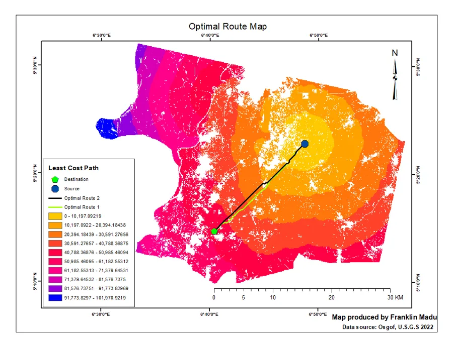
Poorly documented geology, difficult terrain, long distances, and abrupt bends all push up the cost of building natural gas pipelines. This study set out to find a better right-of-way for the 20-inch ANOH gas pipeline before mainline construction, using GIS rather than paper maps.
Environmental, engineering, man-made, natural, socio-cultural, and economic criteria — land use and land cover, slope, roads, rivers, existing rights-of-way, and geology — were built from Landsat 8 imagery, SRTM elevation data, and national survey datasets. The Analytic Hierarchy Process weighted each criterion through pairwise comparison, and the weighted overlay produced a discrete cost surface. From there, cost-distance and backlink rasters drove a least-cost path search between the documented source and destination.
Both optimal routes came out shorter than the existing 28 km right-of-way — 22.42 km and 21.78 km — and avoided every river, road, and pipeline crossing the existing route makes. That matches the 15–30% savings the literature attributes to GIS-based least-cost routing, and supports using the method as a standard preliminary step in route selection.
From the field